Purple Lizard Map - Ohiopyle/Laurel Highlands
The Ohiopyle-Laurel Highlands Lizard Map will help you plan all your adventures in and around Forbes State Forest, Ohiopyle State Park and the Laurel Highlands region.
These maps are AMAZING!! Thank you for making them❤️❤️❤️❤️ - Danielle from PA
A beautifully designed, easy to read topographic map featuring contour lines, elevation data, shaded relief, and all the key details you need to plan your adventures: backroads and trails, trail use designations, road surfaces (paved/gravel/4wd), parking access, campsites, public lands, historic sites and more.
This beautiful region includes parks and forests, quaint mountain and river towns, and tons of opportunity for outdoor recreation, family activities and visiting historic sites. Hiking, biking, boating, camping - this part of Pennsylvania has it all!
"Got my map today in time to plan our biking/hiking/rafting trip to Ohiopyle State Park next week. This map is so frigging detailed I told my wife we don’t even need to take the trip – we can just find endless adventures simply gazing at the map!" - Gordon in North Carolina
Super easy to get to: Located within 200 miles of several major metro areas including Pittsburgh, Washington D.C., Baltimore, Cleveland and Columbus, Ohiopyle-Laurel Highlands offers something for every outdoor enthusiast.
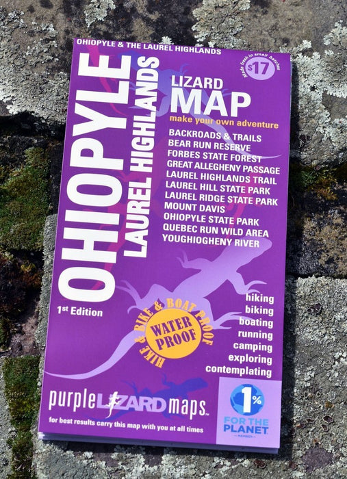
Lizard Maps are durable, waterproof, and give you the big picture – the map opens to 24” x 36” and folds easily to 4” x 8” to fit in your back pocket. One side features the Laurel Highlands region at a scale of 1:87,000 (1 inch = 1.3 miles) and the other side is a detailed map of Ohiopyle State Park at a scale of 1:27,200 (1 inch = 0.4 mile). Includes both lat./lon. and UTM coordinate systems.
Public land: seven Pennsylvania State Parks: Laurel Ridge, Laurel Hill, Laurel Summit, Laurel Mountain, Linn Run, Kooser, Ohiopyle; and most of Forbes State Forest, Bear Run Reserve at Fallingwater, State Game Lands 50, 51, 82, 111, 265, 271, 296; and much of Western Pennsylvania's famed Laurel Highlands.
Destinations: historic sites of Fallingwater and Kentuck Knob, Ferncliff Peninsula National Landmark, Fort Necessity National Battlefield, Braddock’s Grave, Jumonville Glen, and the Flight 93 National Memorial.
Roads: all Lizard Maps show which roads are paved, dirt/gravel or 4wd roads as well as which are gated. Perfect for bicyclists, dual sport riders and overlanders looking to put together a remote backcountry route across public lands.
Major hiking trails: miles 0-46 of the Laurel Highlands Hiking Trail (LHHT) from its beginning at Ohiopyle State Park north to the Rt 30 Shelters, including designated Adirondack Shelters along the route, trailhead parking access, permit information, and distance between shelters.
Major biking trails: over 80 miles of the Great Allegheny Passage (GAP) Rail Trail, including the Big Savage Tunnel, the Eastern Continental Divide, Keystone Viaduct, Salisbury Viaduct and Pinkerton Tunnel from the PA/MD state line to the PA Turnpike at Smithton, PA.
Even more trails! Lizard Maps highlight and designate public trails and paths including hiking, biking, equestrian, skiing, snowmobiling and rail trails managed by federal, state and local authorities, including Sheepskin Trail, Coal and Coke Trail and the Indian Creek Valley Trail.
Points of interest: campgrounds, picnic areas, river access, boat launches, climbing areas, reservable car camping sites, scenic overlooks, observation towers, waterfalls and lizard spots.
Natural Areas plus and special designated areas: Quebec Run Wild Area, Roaring Run Natural Area and Mount Davis - the highest point in Pennsylvania. For boaters the Middle and Lower sections of the Youghiogheny River with rapid names, put-in and take-out locations; Youghiogheny River Lake, Cranberry Glade Lake, High Point Lake and the Quemahoning Reservoir. The many waterfalls of Ohiopyle and the Laurel Highlands are noted, as well as the historic covered bridges throughout the region.
Towns: Addison, Connellsville, Confluence, Donegal, Meyersdale, Mount Pleasant, Perryopolis, Scottdale, Smithton, Somerset, and Uniontown, PA.
Lizards! The little purple Lizards you’ll find scattered on the map signify an interesting spot to check out. The Legend says “ This Could Mean Anything: cool place, sweet view, local legend”.
Want to dive in and start planning? Order the downloadable Ohiopyle-Laurel Highlands Adventure List - the perfect companion to your Ohiopyle-Laurel Highlands Map!